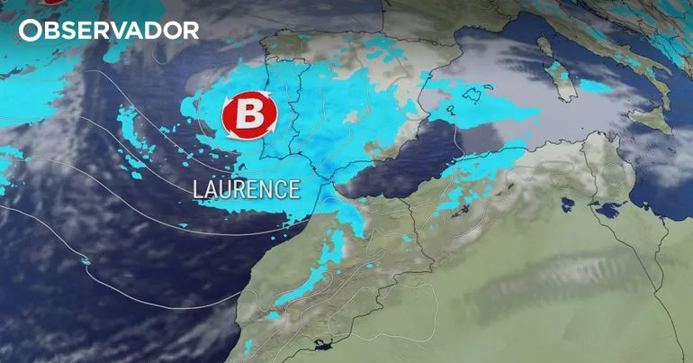
Storm Laurence Approaches
It seems repetitive, but the weather models predict that the effects of Storm Laurence will linger until the end of next week, making March one of the wettest months in recent years. The next storm will hit from Sunday into Monday, named after the Azores by the Portuguese Institute of Sea and Atmosphere (IPMA). This storm will bring a cold front impacting the Azores first, followed by heavy rain, thunderstorms, hail, and snow on the mainland.
Areas Affected
In the Azores, the impacts are expected to begin Saturday afternoon, with northwest winds possibly exceeding 110 km/h in the Western Group, 120 km/h in the Central Group, and 100 km/h in the Eastern Group. Wave heights may reach 9 meters in the Central and Eastern Groups and 8 meters in the Western Group. Yellow and orange alerts have been issued for wind and maritime agitation through the weekend, extending to Madeira due to heavy rain predictions.
Weather Forecast
On the mainland, after a brief clear sky on Friday, rain will return by Saturday evening. Snow is expected above 1000/1200 meters, with a drop in minimum temperatures, particularly in the interior, leading to frost formation. The most intense rain is forecasted for the southern regions, although no alerts have been issued yet.
Future Weather Patterns
From March 17, more Atlantic storms will arrive, continuing to impact the weather in southern regions. The island high-pressure system is keeping the Atlantic storms directed towards Portugal, with another significant storm expected on March 19. This trend of wet weather is likely to continue, with temperatures slightly rising but rain persisting into the following week.

As we welcome this much-needed rain and snow, it’s crucial to remain vigilant of the potential disruptions it may cause.


Comments
Join Our Community
Sign up to share your thoughts, engage with others, and become part of our growing community.
No comments yet
Be the first to share your thoughts and start the conversation!